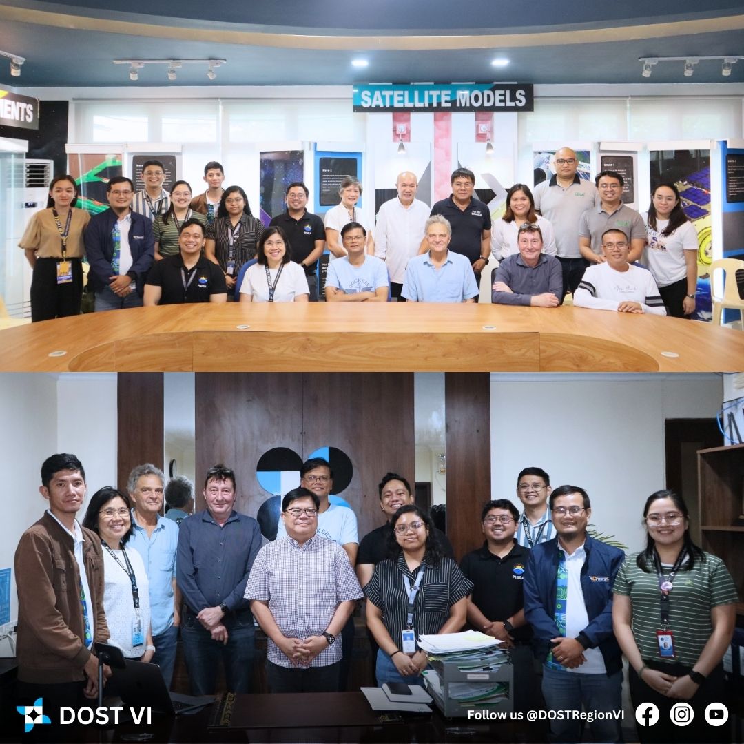
In a significant step towards advancing space technology in the region, scientists from the National Aeronautics and Space Administration (NASA) and representatives from the Philippine Space Agency (PhilSA), in collaboration with the Department of Science and Technology Region VI (DOST VI), visited the Knowledge Center for Weather, Atmospherical, Astronomical, and Geophysical Observations (KWAAGO) Facility in Dumangas, Iloilo on February 17, 2025.
As part of the Land-Use/Cover Changes (LCLUC) in Southeast Asia – Regional Environmental Impacts and Synthesis event, this visit, facilitated by the DOST VI, Iloilo Science and Technology University (ISAT U), and the local government unit of Dumangas (LGU Dumangas), underscores a dynamic collaborative effort to enhance and utilize space-based technologies for environmental monitoring and sustainable development in the region.


The NASA delegation, composed of Dr. Krishna Prasad Vadrevu, Remote Sensing Scientist and Deputy Program Manager of the NASA LCLUC Program; Dr. Eric Vermote, Research Physical Scientist at NASA Goddard Space Flight Center; and Dr. Christopher Justice, Program Scientist for NASA LCLUC and Professor at the University of Maryland College Park, joined forces with the PhilSA team led by Dr. James Cesar Refran, Officer-in-Charge of the Earth Sciences Space Mission Studies Division. This joint effort with DOST VI representatives, Engr. Rowen R. Gelonga, Regional Director, Engr. Sheila L. Oberio, Iloilo Provincial S&T Director, and Engr. Christian James C. Jandayran, Disaster Risk Reduction Management Office (DRRMO) Head, centered on future plans to enhance the use of remote sensing and Earth observation data for disaster preparedness, agriculture, and land-use planning in Western Visayas and highlighted the importance of scientific cooperation in leveraging remote sensing technologies for climate resilience and agricultural advancements.
The central focus of the visit was the KWAAGO Facility, an educational hub designed for understanding space, weather observation, and remote sensing technologies Equipped with advanced computers running specialized applications, KWAAGO serves as a dynamic learning environment, hosting exhibits, lectures, interactive activities, audio-visual presentations, and seminars. The facility will also function as a vital local data repository, storing weather and remote sensing data gathered from satellite subscriptions, automated weather instruments, Doppler radars, and Climate Field School data.


Following their visit in KWAAGO, was their visit in the Dumangas Ground Receiving Station where they witnessed how remote sensing technologies are being applied to support climate-resilient farming, real-time land and weather monitoring, and sustainable agricultural practices. This facility boasts a 3.5-meter satellite tracking antenna, a testament to the collaborative efforts of DOST-Advanced Science and Technology Institute’s (ASTI) Understanding Lightning and Thunderstorms Project (ULAT) and the Japan International Cooperation Agency’s (JICA) Science and Technology Research Partnership for Sustainable Development Program.
This collaborative engagement reinforces the commitment of both local and international agencies to fostering advancements in space technology applications for the benefit of the Iloilo community and the broader region.(CJCJandayran, JMFLatoza/DRRMO)